Discover how drones are helping farmers reduce losses and boost yields!
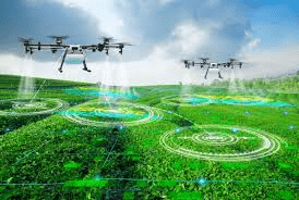
How drones are used in agriculture for mapping, pest detection, and crop health. Include drone footage and animation to explain precision spraying and NDVI.
Learn more tips on www.Agric4Profits.com. Subscribe to stay updated.
#farming #drones #farmingdrone #drone #dronevideo #pestcontrol #aerialmapping #smartfarming #farmer #farm #farmlife #farmers