Geographic Information Systems (GIS) have brought transformative changes to many sectors, and agriculture is no exception. This technology has enabled farmers, researchers, and policymakers to collect, analyze, and interpret spatial and geographic data in ways that enhance agricultural productivity and sustainability.
GIS supports precision farming, improves crop management, and helps in better resource utilization. Let’s delve into the various ways GIS is revolutionizing agriculture.
Geographic Information Systems (GIS) are systems designed to capture, store, manipulate, analyze, manage, and present all types of geographical data. It integrates different types of data, organizes them spatially, and allows users to visualize, question, and interpret this data to understand relationships, patterns, and trends.
GIS combines spatial data (such as maps) with attribute data (such as information about the features on the maps), providing a powerful tool for analysis and decision-making.
Applications of GIS in Agriculture

1. Precision Farming: Precision farming, also known as precision agriculture, involves managing field variability to optimize agricultural production. It aims to apply the right amount of input at the right time and place to maximize crop yield and minimize waste.
GIS plays a crucial role in precision farming by enabling the mapping of fields, monitoring of crop health, and efficient management of resources. Using GPS-equipped machinery, farmers can apply water, fertilizers, and pesticides only where needed, which reduces waste and lowers costs. For example, GIS can help create variable rate application maps that guide machinery in the precise application of inputs, leading to more uniform crop growth and higher yields.
2. Soil Mapping and Analysis: GIS allows for precise soil sampling at various points within a field, creating detailed soil maps that reveal spatial variability in soil properties.
Information on soil texture, moisture content, pH, organic matter, and nutrient levels is integrated into GIS. This helps farmers understand soil fertility and health, enabling them to make informed decisions about soil management practices. For example, farmers can use GIS to identify areas that need lime to adjust pH levels or areas that require additional nutrients.
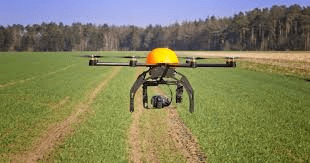
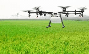
3. Crop Monitoring and Management: Satellite and drone imagery, combined with GIS, provides real-time data on crop health and development. These images can be analyzed to detect issues such as nutrient deficiencies, pest infestations, and water stress.
GIS tools like the Normalized Difference Vegetation Index (NDVI) are used to assess plant health and predict yields. NDVI measures the difference between near-infrared (which vegetation strongly reflects) and red light (which vegetation absorbs), providing an indication of plant health and vigor.
4. Irrigation Management: GIS helps in mapping water sources such as rivers, lakes, and groundwater aquifers. It also assists in planning efficient irrigation systems by analyzing the spatial distribution of water resources and crop water requirements.
By understanding the water requirements of crops through evapotranspiration mapping, GIS aids in optimizing water use. This ensures that crops receive adequate moisture without wastage, which is particularly important in arid and semi-arid regions where water resources are limited.
5. Pest and Disease Management: GIS can map and predict the spread of pests and diseases based on environmental conditions and historical data. This allows for early detection and intervention, reducing crop losses.
By identifying hotspots of pest and disease activity, farmers can target interventions more effectively. This targeted approach reduces the spread and impact of pests and diseases, leading to healthier crops and higher yields.
6. Land Use and Planning: GIS helps determine the best use of land based on various factors such as soil type, topography, climate, and water availability. This analysis ensures that land is used optimally for agricultural production.
By analyzing the impacts of different farming practices, GIS supports sustainable agriculture. It helps in planning crop rotations, conservation practices, and land management strategies that protect soil health and biodiversity.
Read Also: Guide To Your Rabbit Housing Requirements
Benefits of GIS in Agriculture

1. Increased Productivity: Precision farming techniques enabled by GIS lead to higher crop yields by ensuring that inputs are applied efficiently and effectively. This optimized approach reduces variability within fields and maximizes production potential.
2. Cost Reduction: Efficient use of inputs like water, fertilizers, and pesticides reduces costs. By applying inputs only where needed, farmers can save money on materials and labor, improving their bottom line.
3. Environmental Protection: Reduced use of chemicals and optimized irrigation practices minimize environmental impact. GIS supports sustainable farming practices that protect soil, water, and biodiversity, contributing to the long-term health of agricultural ecosystems.
4. Data-Driven Decisions: GIS provides valuable insights that support informed decision-making in agriculture. By analyzing spatial data, farmers can make better decisions about crop management, resource allocation, and land use.
5. Risk Management: By predicting and managing risks such as pests, diseases, and adverse weather conditions, GIS enhances the resilience of farming operations. This proactive approach reduces the likelihood of crop losses and ensures more stable production.
Challenges and Limitations
1. High Initial Costs: Implementing GIS technology can be expensive, requiring significant investment in equipment, software, and training. Small-scale farmers and those in developing regions may find it challenging to afford these costs.
2. Technical Expertise: Effective use of GIS requires specialized knowledge and training, which may not be readily available in all farming communities. Farmers need to understand how to collect, analyze, and interpret spatial data to fully benefit from GIS technology.
3. Data Quality and Availability: The accuracy of GIS applications depends on the quality and availability of spatial data, which can vary by region. In areas with limited data infrastructure, obtaining accurate and up-to-date data can be a challenge.
4. Integration with Existing Systems: Integrating GIS with other farm management systems and technologies can be complex and challenging. Ensuring compatibility and seamless data exchange between different systems is essential for effective implementation.
Read Also: Rabbit Health and Diseases and How to Minimize Major Stresses
Future Trends

1. Integration with IoT: The Internet of Things (IoT) will further enhance GIS applications in agriculture by providing real-time data from sensors placed in fields. These sensors can monitor soil moisture, temperature, and crop health, providing farmers with up-to-the-minute information for better decision-making.
2. Big Data and AI: Combining GIS with big data analytics and artificial intelligence (AI) will lead to more advanced predictive models and decision-support systems. These technologies can analyze vast amounts of data to identify patterns and trends, providing insights that drive smarter farming practices.
3. Climate Change Adaptation: GIS will play a critical role in helping agriculture adapt to climate change. By analyzing and predicting the impacts of climate change on crop production, GIS can help farmers develop strategies to mitigate risks and improve resilience.
4. Mobile GIS: Mobile applications will make GIS tools more accessible to farmers, allowing for real-time data collection and decision-making in the field. Mobile GIS applications can provide farmers with easy-to-use tools for mapping, monitoring, and managing their crops from their smartphones or tablets.
Conclusion
Geographic Information Systems (GIS) have become indispensable in modern agriculture, offering tools for precision farming, resource management, and decision support. While there are challenges in implementing GIS, the benefits in terms of increased productivity, cost savings, and environmental sustainability are significant. As technology continues to evolve, GIS will play an even more critical role in shaping the future of agriculture, ensuring food security, and promoting sustainable farming practices.
GIS’s ability to integrate and analyze vast amounts of spatial data provides farmers with the insights they need to make informed decisions. This technology supports precision farming techniques that optimize resource use and increase crop yields, leading to more efficient and sustainable agricultural practices. Despite the challenges, the future of GIS in agriculture is promising, with ongoing advancements in IoT, big data, AI, and mobile applications set to further enhance its capabilities.
GIS is not just a tool for mapping and data analysis; it is a powerful enabler of modern agricultural practices that drive productivity, sustainability, and resilience. By harnessing the power of GIS, farmers can meet the challenges of today and the future, ensuring a more prosperous and sustainable agricultural sector.
Read Also: Waste To Fertilizer: What You Need to Know
Frequently Asked Questions
We will update this section soon.
